21st Stage

21st Stage

Home > 21st Stage

Cebreros – Ávila (37,2 km)

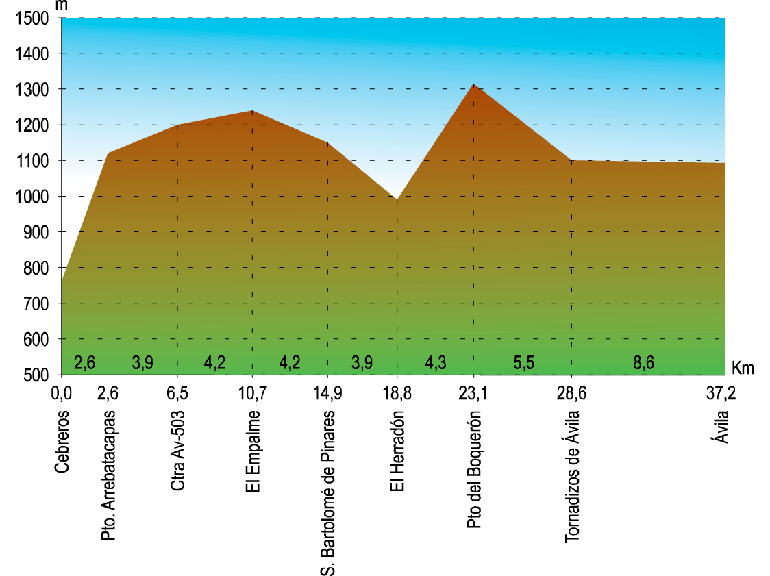
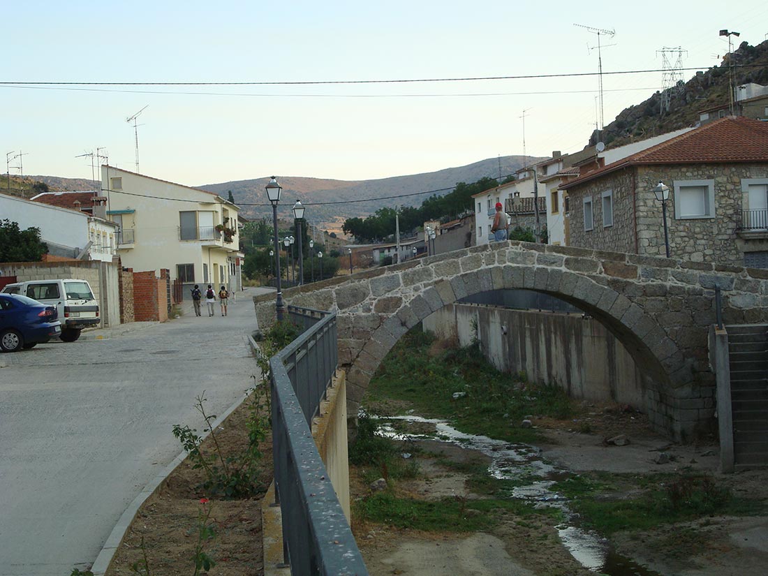
If you think you won’t be able to walk the 37.2 kilometers to Ávila, remember that in San Bartolomé de Pinares, 14.9 kilometers away you have a hostel.

Following the Constitution Avenue, you arrive at the Adolfo Suárez and the Transition Museum, and turn left onto the street of the same name, until you reach the El Burguillo road that crosses, continuing along the street in front, leaving some wine cellars on the left. Cyclists are advised to continue along the road, despite the unevenness of the ascent and descent of the port of Arrebatacapas.

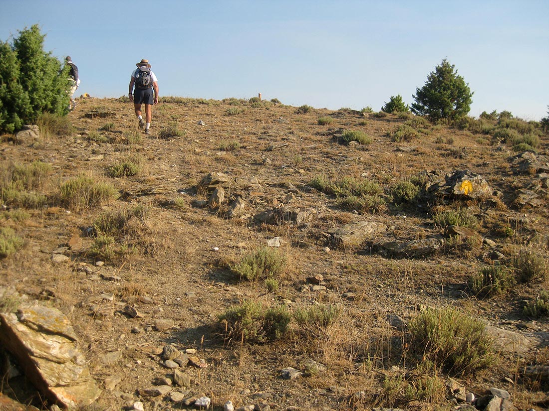
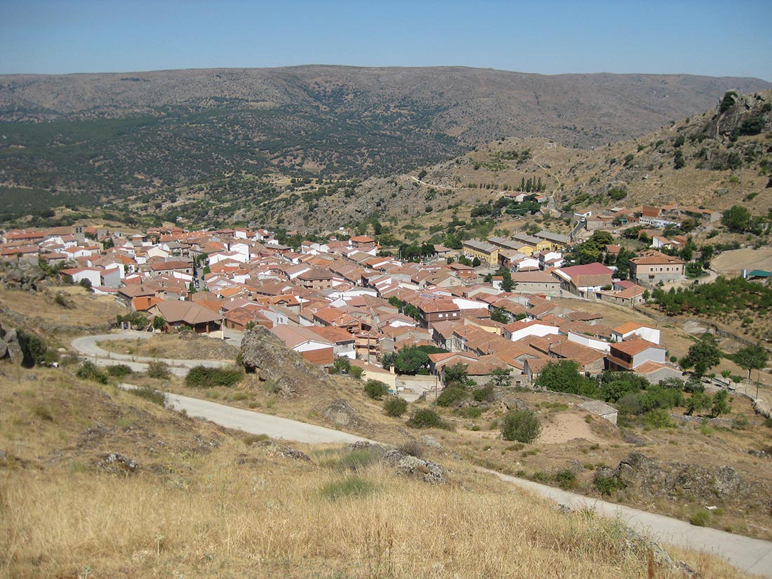
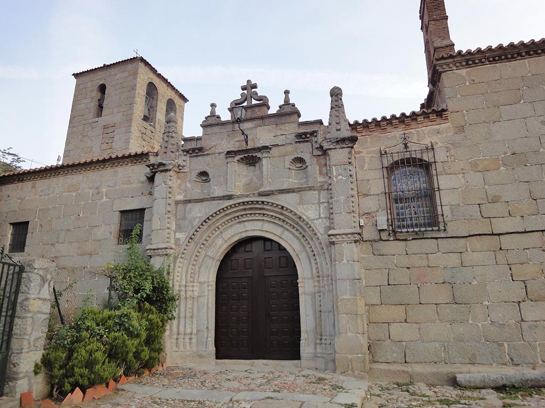
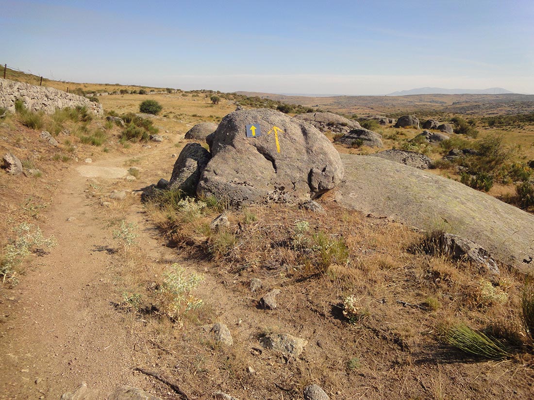
Along the wide path marked C-3, C-9 and Cº Valencia-Santiago de Compostela, go up about 300 metres. At the bend, leave the wide path and follow the short distance path (PR), marked in yellow and white, up to the metal defence of the road: at this point there is kilometre 39. Cross the road and follow the path again with PR marks and yellow arrows. From here look at the ground you are stepping on because you will walk on a medieval path, with perfectly preserved cobblestone, and thus, without realising it, you will have reached the Port of Arrebatacapas (when the wind blew the layers of the villagers and pilgrims were carried away), having saved a difference in height of 250 metres in just 1.8 kilometres. At this point you cross the road and enter a path following the C-5, a short path, and the GR 10-3, a long path, towards the fountain of La Lastrilla. From there, continue along the Cañada Oriental to the Fuente de la Pizarra, next to the stream of the same name, which you cross and continue straight ahead without leaving the road. At this point, the path climbs again close to the fence and continues along it for about 2 kilometres, leaving the road at the height of kilometre 27. Walk 100 metres along the road and on the right you will find another gate that must be opened and closed again. Follow this path marked with the yellow arrows until you reach the AV-P 307, kilometre 9, which you must cross to enter another fenced enclosure. There is another cattle gate that you must close, and as soon as you enter, on the right, there is a path with stones and wheels, which you must follow. At the beginning it runs parallel to the road we have crossed, then it turns to the left, passing by stone fences, pay attention to the yellow arrows and the ribbons hanging from some bushes. When you realise that you are on the Roman road and contemplating the village of San Bartolomé, which you enter from the north, next to the hermitage of Cristo de la Vera Cruz, after passing through a fountain and granite moles. The landscape does not disappoint.

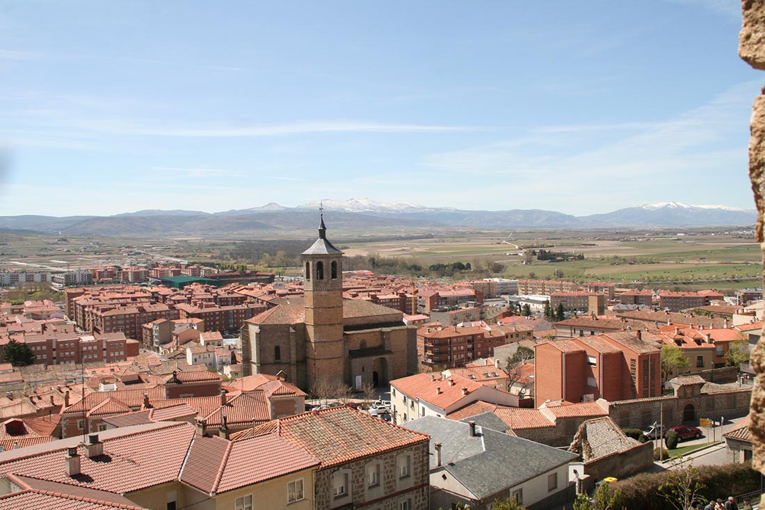
From Cebreros to Ávila, the Provincial Council of Ávila has also signalled this route as the Teresian Route: “Ruta de los caminos y posadas” (Route of the paths and inns).

SAN BARTOLOMÉ DE PINARES

AlbergueFuenteBarComidasPensión - HotelTiendaBanco - Caja de AhorrosOficina de CorreosMédicoFarmaciaCasa RuralPolicía - Guardia CivilEstación de AutobusesTestimonio Jacobeo

He had the House of the Inquisition, on whose lintel a flower and a scallop had been carved. The church is of Herrerian style, it has two buttresses that flank the door, finished off in pinnacles. In the Town Hall Square you can see the statue of Cascorro, a local hero. In Easter, the typical foods are the sweet bolla and the bodiga.

On the 16th of January there is a festival known as the “luminarias” which are nothing more than huge bonfires. The locals decorate their horses and the riders jump over the bonfires that are scattered throughout the village. As in other places in Spain, they are dedicated to San Antonio Abad, the patron saint of animals.

  • Town Hall: La Virgen, 1. Tel: 920 270 001
  • Municipal Pilgrims’ Hostel in Health Centre: Tel: 605 349 788. 8 places.
  • Hostal “El Patio”: Calle de la Paloma. Tel: 681 972 705 (José).
  • Rural House “El Molino”: La Iglesia, 14. Tels: 920 206 204 / 685 886 664

From San Bartolomé de Pinares take the Mayor Street, La Paloma Street and Barco Street, where there is a large fountain. Continue uphill (in front of you, a large granite mass) and the path opens into two, one paved and one dirt; turn left into the dirt path, which is called Camino de la Nava. Go past the football field on the left; on the right there is a fountain with a drinking trough. After 1.6 kilometres turn left again; on the right there are granite stones forming a hill. After 100 metres there is a gate or gate that has to be left closed, you go down the path with remains that look like a road, cross the Arroyo del Roble (in front, the high tension towers and the road to Santa Cruz de Pinares), turn right and after 100 metres you will find El Herradón. Total, 3.9 kilometers.

EL HERRADÓN DE PINARES

FuenteBarComidasTiendaMédicoCasa Rural

It is crossed by the Gaznata stream, which rises at the Cuadrón fountain and flows into the Alberche at the height of the Burguillo reservoir. In the square there is a 15th century fountain and a medieval bridge, restored after a great flood. The church has been declared a historical monument and is an authentic jewel of Gothic-Isabelline style, with an excellent coffered ceiling and a beautiful altarpiece. It is dedicated to Santa María la Mayor. The Town Hall dates from the 18th century and was built during the reign of Carlos III.

  • Town Hall: Plaza Mayor, 1. Tel: 920 270 101
  • Rural House El Médico I and II. C/ Mediodía, 63

You leave El Herradón along the Calle Mayor, after crossing the medieval bridge over the Gaznata stream. The paved road leads to the Hermitage, about 800 metres away. A little further on, to our left there is a rising path, which we follow, and the path becomes a passable path, very well signposted with yellow arrows. This path widens at one point, all of it being cattle track, very muddy, due to the Arroyo Cañada los Carriles, as you get closer to the AV-503 road, which you pass under following the stream. Passing to the other side, you go up a small embankment that continues with a path that, among the indifferent looking cattle, takes you to the top of Puerto del Boquerón, 1316 meters. This way you save 2 kilometers long.

Cyclists are advised to take the road (a long climb up to Puerto del Boquerón).

Cross the road and enter leaving behind the gate that we have found. Continue straight on towards a high tension post, following the tracks that mark a path, imperceptible at the beginning, that guide our steps. The path is very well signposted with yellow arrows that are usually seen from afar, so there is no possibility of loss. The gates that emerge as we go along must be opened and left closed as we have found them: they are not private estates, but public spaces that require a certain control over livestock. Without losing your arrows and looking at the crossroads, with the stream first to the right and then to the left, you arrive at a point where you have to enter a tunnel that passes under the road CL-505, to exit at

TORNADIZOS DE ÁVILA

BarTiendaFarmaciaCasa Rural

So far it’s about 2 hours walk, that’s about 8 kilometers. We cross the village and, passing in front of the cemetery, we are going to look for the Fresnillo farmhouse.

  • Town Hall: Plaza Mayor, 920276106
  • Casa rural El Mendrugo
  • Casa rural La Casita de Laura
  • Casa rural la Arbolea

Take a path to the left and cross the Cañada de los Baldíos stream. After 2 kilometres, cross the Sequillo stream over a Roman bridge. From here to Ávila there are 1.2 kilometers.

ÁVILA

AlbergueFuenteBarComidasPensión - HotelTiendaBanco - Caja de AhorrosOficina de CorreosMédicoFarmaciaCentro de SaludTienda de BicisCampingPolicía - Guardia CivilEstación de AutobusesTestimonio Jacobeo

You enter by the Juventud Avenue, you pass by the Jesús del Gran Poder street and in front of the Provincial Hospital, you cross the Nuestra Señora de Sonsoles street, Cebreros, Plaza de las Losillas and you arrive at the Santiago Church, with a great number of Jacobean symbols. It is followed by Francisco Gallego Street, Bajada del Peregrino and San Segundo Street.

Ávila is the ancient Avela of the Romans. It was the residence of several Castilian kings and the seat of several courts. Today it is the best preserved walled medieval city in the world. Its walls began to be built in 1090 by order of Raimundo de Borgoña, they are of Romanesque style and have an approximate route of two kilometers and a half. It has eight gates, the most monumental of which are those of San Vicente and the Alcázar. It belongs to the Region of Ávila.

  • Town Hall: Plaza de la Victoria, 1. Tel: 920 354 000.
  • Local Police: Tel: 920 354 000, Ext 911
  • Pilgrims’ hostel “Las Tenerías”: In the San Segundo Environmental Centre. Asociación Amigos del Camino de Santiago de Ávila. Tel: 699 327 792. 8 places
  • Residence Colegio Menor “Colegios Diocesanos”. C/ Lesquinas, 2. Telephone: 920212300.  Reservas: residenciacolegiodiocesano@dioceavila.com
  • Hostal Don Diego: C/ Marqués de Canales y Chozas, 5. Tel.: 920 255 475
  • Hostal “Rey Niño”: Plaza de José Tomé, 1. Tel: 920 211 404
  • Hostal “Puerta del Alcázar”: San Segundo, 38. Tel: 920 211 074
  • Hotel “El Pinar”: Carretera de Valladolid.

It is worth visiting the city and its most representative monuments: the Church of Santiago in the southern suburb, the Cathedral that was begun in the 12th century, the basilica of San Vicente, the church of San Pedro, the Convent of San Antonio that was founded by Don Rodrigo del Águila (knight of the habit of Santiago), the chapel of Mosén Rubí de Bracamonte, the hermitage of San Martín. etc., and of course, the house of Santa Teresa!

Ávila had ten hospitals.